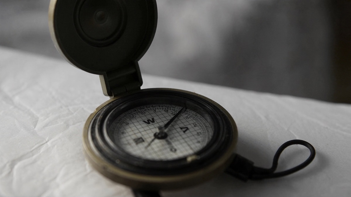
A compass needle points toward magnetic north because it is itself a small, freely pivoting magnet responding to Earth's own vast magnetic field, generated deep inside the planet's molten core. That alignment is reliable enough to have guided sailors, hikers, and pilots for centuries, but the needle actually tracks a wandering magnetic pole rather than the fixed geographic North Pole, a gap navigators have had to account for since the earliest days of open-sea travel.
Why a Compass Needle Always Points Toward Magnetic North
A compass needle is a thin sliver of magnetized metal mounted on a nearly frictionless pivot, free to rotate in any direction until it settles into equilibrium with whatever magnetic field surrounds it. In open air, far from other magnets, that surrounding field is Earth's own, so the needle naturally swings until its north-seeking end aligns with the planet's magnetic field lines.
This works the same way two bar magnets align when placed near each other: opposite magnetic poles attract, so the needle's north pole is drawn toward the region where Earth's field lines converge, which happens to sit near the geographic north. The needle does not know or care about geography; it simply obeys the physics of magnetism acting on its own tiny magnetic field.
How Earth's Molten Core Actually Generates a Magnetic Field
Earth's magnetic field originates roughly three thousand kilometers below the surface, where a solid inner core of iron and nickel is surrounded by a liquid outer core of the same metals in constant, churning motion. As this electrically conductive liquid metal flows, driven by heat escaping from the core and the planet's rotation, it generates electric currents, and those currents in turn produce a magnetic field, a self-sustaining process scientists call the geodynamo.
This mechanism is remarkably similar to how a bicycle dynamo generates electricity from motion, except on a planetary scale and running continuously for billions of years. The geodynamo is not perfectly stable: its strength fluctuates gradually over centuries, and the magnetic poles themselves slowly drift and have even fully reversed polarity many times across Earth's geological history.
The Difference Between True North and Magnetic North
True north refers to the fixed geographic North Pole, the point where Earth's axis of rotation meets its surface, and it never moves. Magnetic north, by contrast, is the point where the planet's magnetic field points straight down into the ground, and it currently sits several hundred kilometers away from true north, drifting slowly over time as the geodynamo shifts.
A compass needle only ever points toward magnetic north, never true north, so any map reading, aviation heading, or nautical course that requires geographic accuracy must apply a correction to translate a compass bearing into a true bearing, or vice versa. Confusing the two without correcting for it can introduce navigational errors of many degrees over long distances.
What Magnetic Declination Actually Means for Navigation
Magnetic declination is the angular difference, at any given location on Earth, between true north and the direction a compass needle actually points. Because the size and direction of this gap vary depending on where you stand on the planet, and because it changes gradually over years, declination values are only valid for a specific place and a specific date.
Topographic maps typically print the local declination directly on the map, along with the date it was measured, and serious navigators adjust their compass bearing by that exact amount before plotting a course. Skipping this correction is one of the most common beginner mistakes in wilderness navigation, and it can send a hiker many degrees off an intended route.
Why a Compass Needle Also Tilts Downward (Magnetic Dip)
Earth's magnetic field lines are not flat; they curve out of the ground near the equator and dive steeply into the ground near the poles, a behavior called magnetic dip or inclination. A compass needle free to move in three dimensions would tilt to follow that angle, pointing nearly level near the equator but almost straight down near the magnetic poles.
Because a tilted needle would drag against its housing and give unreliable readings, manufacturers counterweight the needle differently depending on which hemisphere a compass is designed for, adding a small weight to the south end in the northern hemisphere and vice versa, to keep the needle balanced and level despite the pull of dip.
How a Compass Needle Is Actually Balanced and Magnetized
A compass needle starts as an ordinary sliver of steel or another ferromagnetic alloy, which is then magnetized by stroking it repeatedly in one direction against a strong permanent magnet, or by placing it inside a coil carrying electric current. This process aligns the microscopic magnetic domains within the metal so they all point the same way, turning the sliver into a weak but stable permanent magnet.
After magnetizing, manufacturers precisely balance the needle on its pivot point so it sits level and rotates freely with minimal friction, since even a tiny imbalance would cause the needle to drag or stick rather than settle accurately. High-quality compasses use a jeweled pivot, often a synthetic sapphire, to minimize wear and keep the needle responsive for decades of use.
Why Most Modern Compasses Are Filled With Liquid
Older dry-card compasses let the needle swing freely in air, which meant it would oscillate back and forth for several seconds after any movement before settling on an accurate reading, an especially serious problem aboard a moving ship or vehicle. Filling the compass housing with a viscous liquid, usually a mineral oil or a light mixture of alcohol and water, dampens that oscillation dramatically.
The liquid resists the needle's motion just enough to bring it to rest quickly without preventing it from turning to follow the magnetic field, and it also lubricates the pivot, reducing wear over years of use. The fluid is carefully formulated to resist freezing in cold climates and to remain stable across a wide temperature range without forming bubbles.
How a Gimbal Keeps a Ship's Compass Level at Sea
A ship's magnetic compass, called a binnacle compass, sits inside a gimbal mount, a set of pivoted rings that let the compass card remain level and horizontal even as the ship rolls and pitches with the waves. Without this arrangement, a tilting deck would tilt the compass bowl along with it, throwing off the needle's ability to align cleanly with Earth's field.
The gimbal's two perpendicular pivot axes allow the compass to counter-rotate against the ship's motion in real time, keeping the compass card essentially horizontal regardless of how much the vessel rocks. This same gimbal principle, borrowed from centuries of maritime compass design, is also used in gyroscopes and other instruments that must stay level on a moving platform.
Why Nearby Metal Can Throw Off a Compass Reading
A compass needle responds to any magnetic field within range, not exclusively Earth's, so ferromagnetic metal objects like knives, belt buckles, car bodies, or steel-hulled ships create local magnetic fields strong enough to pull the needle away from true magnetic north. This distortion, called deviation, is distinct from declination because it comes from nearby objects rather than the planet's own field.
Even electronic devices with small motors or speakers can introduce enough stray magnetism to skew a reading if held too close to a compass. Experienced navigators routinely hold a handheld compass well away from their body, backpack buckles, and any electronics, and they know that a compass mounted inside a vehicle needs its own separate correction for the vehicle's own deviation.
How Sailors Actually "Swing" a Ship's Compass to Correct It
Because a ship's own steel hull, engines, and electrical systems create a persistent local magnetic field, every vessel's compass develops its own unique deviation pattern that changes depending on which direction the ship is pointing. To measure and correct for this, technicians perform a procedure called swinging the compass, slowly rotating the anchored or dock-side ship through a full circle while comparing compass readings against known true bearings.
The resulting deviation values, recorded at set heading intervals, are written onto a deviation card kept near the compass, which the crew consults to correct any reading for that specific heading. Modern ships repeat this procedure periodically, especially after major structural repairs or new equipment installation, since anything that changes the ship's magnetic signature can shift the deviation pattern.
The Ancient Chinese Origins of the Magnetic Compass
The magnetic compass traces back to ancient China, where naturally magnetized iron ore called lodestone was first used, as early as the second century BCE, not for navigation but for geomancy and divination practices related to feng shui, aligning buildings and graves with favorable directions. Early diviners noticed that a freely spinning lodestone spoon always settled pointing the same way.
It took several more centuries before Chinese navigators adapted this property for maritime use, floating a magnetized needle on water or suspending it from a thread to guide ships, a practice documented by the eleventh century. The technology spread gradually westward along trade routes, reaching the Islamic world and Europe by the twelfth century, where it was refined into the pivoted needle design still recognizable today.
How the Compass Rose on Maps Actually Got Its Design
The compass rose, the decorative star-shaped diagram marking cardinal and intercardinal directions on a map, evolved from the wind rose used by ancient Mediterranean sailors to represent the eight or more named winds that shaped early navigation before magnetic compasses became common. Each wind direction had a name and an associated point on the diagram.
As magnetic compasses spread through medieval Europe, mapmakers merged the older wind rose tradition with compass bearings, and by the fourteenth century elaborate, ornately decorated compass roses had become a standard, often beautifully illustrated feature of portolan charts used by Mediterranean sailors, eventually standardizing into the simpler thirty-two-point rose still printed on maps and compasses today.
How a Military Lensatic Compass Differs From a Basic One
A military lensatic compass adds a rear sighting lens, a front sighting wire, and a hinged cover that doubles as a straightedge, allowing a user to take an extremely precise bearing on a distant landmark by aligning the sight and reading the degree scale through the magnifying lens simultaneously. This design trades some of the simplicity of a basic baseplate compass for significantly higher precision.
It also typically includes a luminous dial and markers that glow after exposure to light, allowing night navigation without a separate light source giving away a soldier's position. Because precise bearing-taking under field conditions can be a matter of life and safety, the lensatic design has remained largely unchanged in military use for decades despite the rise of GPS.
Why Airplanes Use Gyrocompasses Instead of Magnetic Ones
A simple magnetic compass swings, dips, and oscillates unpredictably during an aircraft's banking turns, accelerations, and vibrations, making it unreliable for precise heading control in flight even though it remains a required backup instrument. Instead, aircraft rely primarily on a gyrocompass or a modern equivalent that uses a spinning rotor's resistance to changes in orientation to maintain a stable heading reference independent of magnetism.
Because a gyrocompass has no connection to Earth's magnetic field at all, it does not suffer from deviation or declination errors, but it does gradually drift off true heading over time due to small mechanical imperfections and Earth's rotation, so pilots must periodically recalibrate it against the magnetic compass or satellite navigation during level, steady flight.
How a Smartphone's Digital Compass Actually Works
A smartphone has no swinging needle at all; instead, it contains a tiny magnetometer chip, essentially a set of solid-state sensors that measure the strength and direction of magnetic fields along three perpendicular axes. Software combines these three readings with data from the phone's accelerometer, which senses which way is down, to calculate a compass heading regardless of how the phone is tilted or held.
This combination lets a flat digital compass app work even when the phone is not held perfectly level, something a simple magnetic needle could never do on its own. The same magnetometer chip also powers augmented reality apps, indoor mapping features, and metal detector apps, since it is simply measuring raw magnetic field data that software can interpret many different ways.
Why Smartphone Compasses Need Frequent Recalibration
A phone's magnetometer chip can develop a small internal magnetic bias over time, and it also picks up interference from the phone's own speaker magnets, camera components, and metal casing, all of which sit only millimeters away from the sensor. This causes the compass reading to drift gradually inaccurate, which is why phones periodically prompt users to wave the device in a figure-eight motion.
That figure-eight motion exposes the magnetometer to the surrounding magnetic field from many different angles in quick succession, letting the phone's software mathematically separate the constant internal interference from the true external field and subtract it out. Skipping recalibration for long periods, especially after being near strong magnets like speakers or magnetic phone mounts, is the most common cause of an inaccurate phone compass.
How Orienteering Athletes Actually Use a Compass at Speed
Competitive orienteering requires runners to navigate between checkpoints across unfamiliar terrain as fast as possible, and top athletes learn to take a compass bearing and hold a running direction without ever stopping or even slowing down, glancing at the compass baseplate for a fraction of a second at a time. This skill, called running on a bearing, takes years of practice to execute reliably at speed.
Rather than continuously staring at the compass, experienced orienteers pick a distant visible feature, like a distinctive tree or rock, that lies roughly along their bearing, then run toward that feature and only recheck the compass once they reach it, repeating the process. This technique is far faster than constant compass-checking while still keeping the runner reliably on course.
Why Earth's Magnetic North Pole Keeps Drifting
The magnetic north pole is not fixed to a specific point of land but is instead the location where Earth's magnetic field currently points straight down, and because the geodynamo generating that field is a fluid, turbulent process, this point drifts over time, sometimes quite rapidly. In recent decades, scientists have tracked the magnetic north pole accelerating from a historical average drift of a few kilometers a year to tens of kilometers a year.
This unusually fast movement, currently carrying the pole across the Arctic Ocean from Canada toward Siberia, forces agencies that maintain global navigation models, such as the World Magnetic Model used in GPS and smartphone compasses, to update their declination data more frequently than the standard five-year cycle to keep digital compass readings accurate worldwide.
How Geologists Use a Compass to Measure Rock Layers
Field geologists use a specialized instrument called a Brunton compass, which combines a magnetic compass with a built-in clinometer, to measure the strike and dip of exposed rock layers, meaning the compass direction along which a tilted rock layer intersects a horizontal plane and the angle at which it tilts downward from that line. These two measurements together fully describe the three-dimensional orientation of a rock formation.
Recording strike and dip measurements at many points across a landscape lets geologists reconstruct the underlying structure of folded or faulted rock layers, which is essential for mapping mineral deposits, assessing earthquake fault lines, and planning safe locations for tunnels, dams, and building foundations. The same basic magnetic compass technology from centuries of navigation turns out to be indispensable underground.
Why Solar Storms Can Temporarily Confuse a Compass
A powerful solar storm sends a burst of charged particles toward Earth that interacts with the planet's magnetic field, temporarily compressing and distorting it in ways that can be strong enough to shift a compass reading noticeably, particularly at high latitudes near the poles where the disturbance concentrates. These events, called geomagnetic storms, can also disrupt radio communication and satellite navigation systems.
For most everyday compass users this effect is negligible, but it has historically caused measurable problems for precise applications like magnetic surveying, oil and gas exploration, and polar aviation, where operators sometimes have to pause magnetically sensitive work during severe geomagnetic storm warnings issued by space weather forecasting agencies until the disturbance subsides.
How a Compass Compares to GPS for Backup Navigation
A GPS receiver calculates position by timing radio signals from orbiting satellites, giving extremely precise location coordinates, but it depends entirely on battery power and a clear line of sight to enough satellites, both of which can fail in dense forest, deep canyons, underground, or simply when a device runs out of charge. A magnetic compass needs no batteries and no signal at all.
For this reason, wilderness safety guides and military survival training almost universally recommend carrying a physical compass and paper map as a mandatory backup to any GPS device, since the compass will keep functioning under conditions, like extreme cold draining batteries or signal-blocking terrain, that reliably defeat electronic navigation. The two tools are best used together rather than as substitutes for one another.
Why a Compass Still Matters in the Age of GPS
Despite decades of satellite navigation dominance, the magnetic compass remains standard equipment in aviation cockpits, ship bridges, military kits, and hiking packs precisely because it is simple, requires no power source, and has no electronic components that can be jammed, hacked, or fail from cold or water damage. Its reliability comes from directly exploiting a physical property of the planet rather than a fragile human-built infrastructure.
Understanding how a compass actually works also builds genuine spatial awareness and navigational judgment that purely following a GPS arrow on a screen does not develop, which is why orienteering, sailing certification, and military training programs continue to require hands-on compass proficiency even for people who will use GPS in practice for most of their actual navigation.
Sources
- Wikipedia — history and mechanics of the magnetic compass
- USGS Geomagnetism Program — data on Earth's magnetic field and declination
- Wikipedia — magnetic pole drift and reversal history
FAQ
Does a compass point to the exact North Pole?
No; it points toward magnetic north, a wandering point several hundred kilometers from the true geographic North Pole, so accurate navigation requires correcting for the local declination.
What actually generates Earth's magnetic field?
Churning liquid iron and nickel in Earth's outer core generates electric currents through motion, and those currents produce a self-sustaining magnetic field known as the geodynamo.
Why does a compass needle sometimes tilt instead of staying flat?
Earth's magnetic field lines dip steeply near the poles, a property called magnetic dip, so an uncounterweighted needle would tilt to follow that angle rather than stay level.
Why are most compasses filled with liquid?
The liquid dampens the needle's oscillation so it settles quickly on an accurate reading instead of swinging back and forth for several seconds after every movement.
Can nearby metal objects really throw off a compass reading?
Yes; ferromagnetic objects like knives, belt buckles, or a car's steel body create local magnetic fields that pull the needle away from true magnetic north, an effect called deviation.
What does it mean to "swing" a ship's compass?
It means rotating the ship through a full circle while comparing compass readings to known true bearings, to measure and record the vessel's own unique magnetic deviation pattern.
Where was the magnetic compass first invented?
It originated in ancient China, where magnetized lodestone was first used for geomancy and divination centuries before Chinese navigators adapted it for maritime use around the eleventh century.
How is a smartphone compass different from a needle compass?
A phone uses a solid-state magnetometer chip that measures magnetic field strength along three axes, combined with accelerometer data, rather than a physical swinging magnetized needle.
Why do phone compasses need the figure-eight recalibration motion?
The motion exposes the magnetometer to the surrounding field from many angles quickly, letting software separate constant internal interference from nearby components from the true external magnetic field.
Why do airplanes rely on gyrocompasses instead of magnetic ones?
A magnetic needle swings unpredictably during banking turns and vibration, while a gyrocompass uses a spinning rotor's resistance to reorientation to hold a stable heading independent of magnetism.
How do orienteering runners use a compass without slowing down?
They pick a distant visible landmark roughly along their bearing, run toward it, and only recheck the compass on arrival, rather than continuously staring at it while moving.
Is Earth's magnetic north pole actually moving?
Yes; it currently drifts across the Arctic from Canada toward Siberia at tens of kilometers per year, a pace that has accelerated compared to the historical average.
What is a Brunton compass used for?
Geologists use it to measure the strike and dip of rock layers, combining a magnetic compass with a built-in clinometer to fully describe a rock formation's orientation.
Can solar storms actually affect a compass?
Yes; powerful geomagnetic storms can temporarily distort Earth's field enough to shift readings noticeably, especially at high latitudes, though the effect is negligible for most casual users.
Should hikers carry a compass even if they have GPS?
Yes; safety guides recommend a physical compass and map as a mandatory backup, since a compass needs no batteries or signal and keeps working when electronic navigation fails.
Why is a compass needle counterweighted differently in each hemisphere?
Magnetic dip pulls the needle down at a different angle depending on hemisphere, so manufacturers add a small counterweight to the opposite end to keep the needle level.
About the Author
We reference Wikipedia and other authoritative sources to explain the background and current understanding of this topic.
Loved This Article?
Share it on WhatsApp → Share it on WhatsApp
Get more guides in your inbox — Subscribe to our newsletter for weekly surprising stories from Egypt, Saudi Arabia, Dubai, and beyond.