Introduction
International borders, despite appearing as fixed, permanent lines on maps, are actually the product of specific historical processes: treaties, colonial-era decisions, natural geographic features, war outcomes, and ongoing legal frameworks that determine where one country's sovereignty ends and another's begins.
Understanding how borders actually get established reveals that the neat lines on a world map often obscure long, sometimes contentious, and occasionally still-unresolved processes of negotiation, historical claim, and international law.
Natural Borders Versus Artificial Borders
Borders generally fall into two broad categories: natural (or physical) borders, which follow existing geographic features like rivers, mountain ranges, or coastlines, since these landmarks provide clear, relatively stable, and often historically defensible dividing lines, and artificial (or geometric) borders, which are straight lines or arbitrary boundaries drawn without regard to physical geography, often based on latitude and longitude coordinates.
Artificial borders are especially common across Africa and parts of the Middle East, largely a legacy of European colonial powers dividing territories administratively during the 19th and early 20th centuries, frequently without meaningful regard for existing ethnic, linguistic, or tribal boundaries, a decision that continues to contribute to regional conflicts and governance challenges in various parts of the world today.
The Legal Mechanisms That Establish Borders
Formally, international borders are established and legally recognized through several mechanisms: bilateral or multilateral treaties between neighboring states, international arbitration or rulings by bodies like the International Court of Justice when countries cannot agree bilaterally, and historical colonial administrative boundaries that many newly independent nations formally adopted upon gaining independence under a principle known as uti possidetis juris (as you possess under law), intended to prevent border chaos during decolonization.
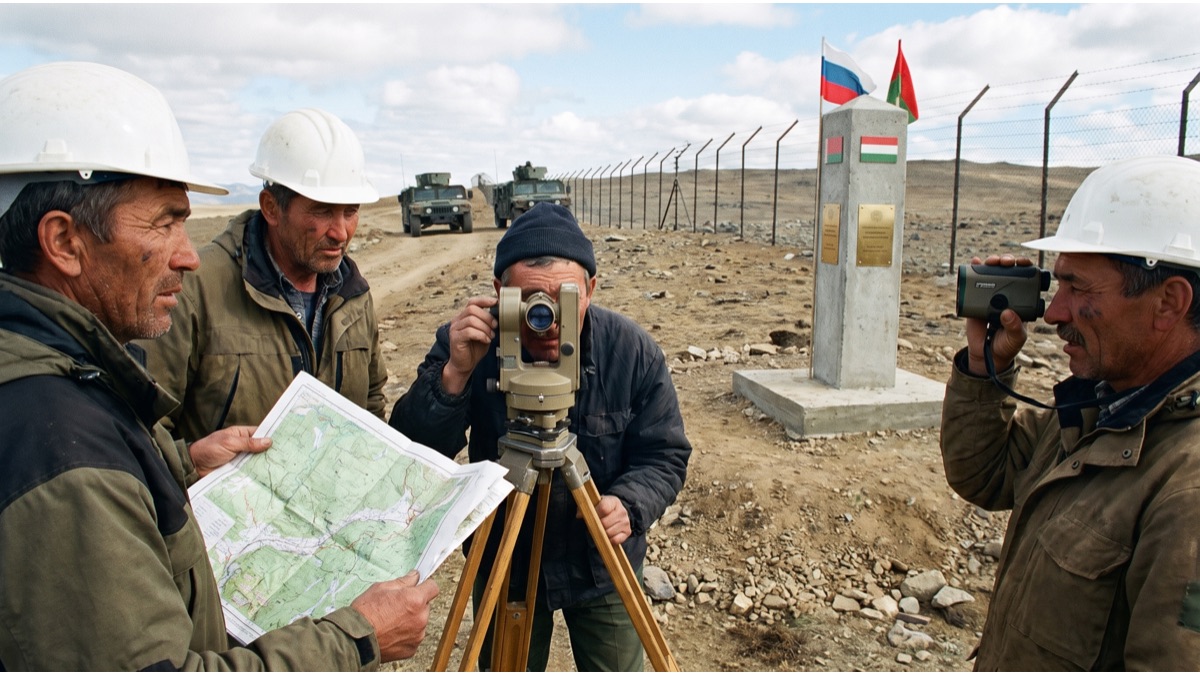
Once established, borders are typically formalized through detailed demarcation — the physical process of surveying and marking the exact border line on the ground, sometimes with physical markers, fences, or boundary stones — a technical process that can take years to complete even after the underlying political agreement is reached.
Why Some Borders Remain Disputed
Not all borders are fully settled; researchers estimate dozens of active international border disputes exist worldwide at any given time, arising from competing historical claims, contested treaty interpretations, natural resource discoveries (like offshore oil or water rights) that increase a border area's strategic value, or simply territory where colonial-era boundary documentation was vague, incomplete, or contradictory.
Some disputed borders remain largely peaceful, managed through ongoing diplomatic negotiation or informal arrangements, while others have historically triggered or continue to fuel active armed conflict, illustrating that a border's legal status and its practical, on-the-ground reality don't always fully align.
How and Why Borders Still Change Today
While most established international borders remain remarkably stable over long periods, they do still change through several recognized processes: negotiated territorial exchanges between neighboring states, the peaceful or contested creation of new independent states (as occurred extensively following the collapse of the Soviet Union and Yugoslavia in the 1990s), and, far less commonly today under modern international law norms, territorial annexation.
The United Nations and broader international legal system generally strongly discourage unilateral, forcible border changes, reflecting a post-World War II international consensus that territorial integrity and existing recognized borders should be respected and altered primarily through negotiation and mutual agreement rather than unilateral force.
Sources
- United Nations — Reference on international law principles governing border recognition and disputes
- International Court of Justice — Official body for resolving international border disputes through legal arbitration
- CIA World Factbook — Reference data on international boundaries and disputed border areas
FAQ
What is the difference between natural and artificial borders?
Natural borders follow existing geographic features like rivers or mountain ranges, while artificial borders are straight or arbitrary lines drawn without regard to physical geography, often based on latitude and longitude coordinates.
Why are so many African and Middle Eastern borders straight lines?
Straight, artificial borders in these regions are largely a legacy of European colonial powers dividing territories administratively during the 19th and early 20th centuries, often without regard for existing ethnic or tribal boundaries.
What is uti possidetis juris?
Uti possidetis juris is a legal principle where newly independent nations formally adopt their previous colonial administrative boundaries as their new international borders, intended to prevent border chaos during decolonization.
How many international border disputes exist today?
Researchers estimate dozens of active international border disputes exist worldwide at any given time, arising from competing historical claims, contested treaty interpretations, or resource discoveries that increase a border's strategic value.
Do international borders still change today?
Yes, through recognized processes like negotiated territorial exchanges and the creation of new independent states, though the United Nations and international legal system strongly discourage unilateral, forcible border changes.
About the Author
doyouknow.app Editorial Team — We reference international law and geography sources to explain how borders are legally established, disputed, and changed.
Loved This Article?
Share it on WhatsApp → Share on WhatsApp
Get more guides in your inbox — Subscribe to our newsletter for weekly surprising stories from Egypt, Saudi Arabia, Dubai, and beyond.