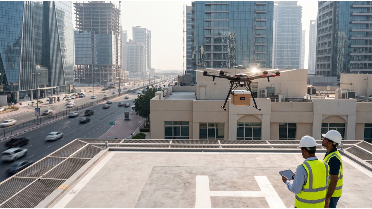
Dubai has quietly built one of the most extensive municipal drone programs in the world, with police, roads authority, utility, and civil defence agencies all operating fleets for purposes that have little to do with the flashy delivery demonstrations most people associate with the technology. Behind the visible pilot projects sits a much larger, ongoing operation: drones inspecting bridges, monitoring traffic incidents, checking construction progress, and supporting emergency response, all governed by a regulatory framework the General Civil Aviation Authority has built specifically to manage this kind of dense, mixed-use urban airspace. Understanding how these programs actually work explains why Dubai treats drones as everyday municipal infrastructure rather than a novelty.
Dubai's Drone Program Is Bigger Than Delivery
When most people think of drones and cities, they picture parcel delivery, the kind of demonstration flight that generates headlines but represents a small fraction of how drones are actually used in dense urban environments.
In Dubai, the larger and more consequential use of drone technology has been in municipal service delivery: multiple government agencies operate their own drone fleets for tasks that range from routine infrastructure checks to emergency response support, work that rarely makes international news but happens continuously.
This distinction matters because it reflects how city governments generally adopt new aerial technology, starting with lower-risk, high-value operational uses like inspection and monitoring, and only later, if regulation and public acceptance allow, moving toward higher-risk applications like delivery over populated areas.
How the RTA Uses Drones for Traffic Monitoring
Dubai's Roads and Transport Authority has used drones to monitor traffic flow and document accident scenes on major roads, providing an aerial vantage point that can assess a multi-vehicle incident or congestion pattern faster than ground-based cameras alone.
Aerial monitoring is particularly useful for large-scale traffic events, including major accidents that require rerouting, where a drone can quickly assess the full scope of a blockage and relay that information to traffic control centers to adjust signal timing or issue driver alerts.
The RTA has also explored drone-based monitoring for construction zones affecting traffic flow, using aerial footage to verify that road diversions and temporary signage are correctly placed and functioning as intended during major infrastructure projects.
Construction Site Inspection From the Air
Given Dubai's continuous pace of major construction, drones have become a standard tool for monitoring building progress, capturing site conditions from angles and heights that would be slow, expensive, or genuinely dangerous to document manually.
Regular aerial surveys let project managers track construction progress against schedule, identify safety hazards like unsecured materials or equipment, and verify that work is proceeding according to approved plans, all without requiring inspectors to physically access every level of an active site.
This use case has expanded to Dubai Municipality's own building compliance inspections, where aerial imagery can help verify that facades, rooftop installations, and other elements match approved permits, a task considerably more efficient from the air than via ground-based site visits alone.
Contractors working on major towers have also begun incorporating routine drone flyovers into their own internal progress reporting, generating dated aerial photo sets that developers and lenders can review remotely rather than requiring an in-person site visit for every progress milestone, a shift that has meaningfully sped up reporting cycles on large projects.
DEWA's Use of Drones for Infrastructure Inspection
Dubai Electricity and Water Authority has used drones to inspect power lines, transmission towers, and other infrastructure that would otherwise require workers to physically climb structures or shut down sections of the grid for manual inspection.
Thermal imaging cameras mounted on inspection drones can detect overheating components or developing faults in electrical infrastructure before they cause an outage, identifying problems during routine surveys rather than after equipment has already failed.
This approach reduces both the safety risk to maintenance workers, who no longer need to climb every structure for a routine visual check, and the operational cost of inspections, since a drone can survey a long stretch of transmission line significantly faster than a ground crew.
How Dubai Police Deploys Drones
Dubai Police operates drones for aerial surveillance at large public events, where crowd size and movement are difficult to assess accurately from ground level, supporting crowd management and helping identify potential safety issues before they escalate.
Drones are also used to document traffic accident scenes from above, providing a comprehensive visual record that supports investigation and insurance processes more efficiently than exclusively ground-level photography, particularly for complex, multi-vehicle incidents on major roads.
Search operations, including efforts to locate missing persons in difficult-to-access terrain, have also used police drones equipped with thermal cameras, extending the search capability of ground teams into areas that would otherwise require significantly more time and personnel to cover.
Dubai Civil Defence and Emergency Response Drones
Dubai Civil Defence has incorporated drones into firefighting and emergency response operations, using aerial views to assess the scale and spread of a fire before committing ground crews, information that can meaningfully affect tactical decisions during an active incident.
Thermal imaging from drones can identify hotspots within a large structure fire that aren't visible from the ground, helping firefighting teams target their response more precisely and monitor for reignition risk after the visible flames have been controlled.
In building collapse or other structural emergency scenarios, drones can assess damage and identify safe access routes for rescue teams without requiring personnel to enter a potentially unstable structure purely to gather initial visual information.
Drone Delivery Pilot Programs in Dubai
Dubai has run several drone delivery pilot programs over the years, testing the technology for use cases including parcel delivery and, in some trials, transport of medical supplies between facilities, generally operating under specific GCAA-approved test conditions rather than as an unrestricted citywide service.
These pilots have typically operated within defined test corridors or over less densely populated areas, reflecting the additional regulatory and safety complexity of flying delivery drones over crowded urban environments compared with the inspection and monitoring flights municipal agencies already operate routinely.
Dubai's broader smart-city strategy has repeatedly cited drone delivery as a long-term ambition, though the pilots conducted so far remain testing and demonstration programs rather than a fully commercial, citywide delivery network available to the general public.
The Regulatory Framework: How the GCAA Governs Drones
The General Civil Aviation Authority is the federal body responsible for regulating drone flights across the UAE, including Dubai, setting the licensing, registration, and airspace requirements that both government agencies and private drone operators must follow.
The GCAA's framework distinguishes between different categories of drone operation based on factors like weight, altitude, and proximity to airports or sensitive facilities, with correspondingly different levels of permit requirements and operational restrictions for each category.
Government agency drone programs, including those run by Dubai Police, the RTA, and DEWA, still operate within this same regulatory structure, obtaining the necessary flight authorizations for their specific operational areas rather than being automatically exempt from airspace rules.
Why Dubai Treats Drone Airspace as a Managed Resource
With multiple government agencies, private operators, and testing programs all potentially wanting to fly drones in overlapping urban airspace, Dubai has approached drone airspace management as a coordination problem requiring active traffic management, not simply a matter of issuing individual permits.
Unmanned traffic management systems, which track and coordinate multiple simultaneous drone flights in real time, have become increasingly important as the number of authorized drone operations in the city has grown, helping prevent conflicts between different agencies' flights in the same airspace.
This coordinated approach reflects a broader pattern in dense cities experimenting with drone integration: airspace above a busy urban area needs active management in ways that airspace over rural or unpopulated land generally does not.
Counter-Drone Systems and Airspace Security
Alongside its own authorized drone programs, Dubai has also invested in counter-drone detection systems designed to identify and, where necessary, neutralize unauthorized drone flights, particularly around airports, government facilities, and major public events.
Unauthorized drone flights near Dubai International Airport pose a genuine operational risk, since even a small drone can force runway closures or flight diversions if detected in restricted airspace, a concern that has led to strict enforcement of no-fly zones around the airport.
This dual approach, actively expanding authorized municipal drone use while simultaneously tightening enforcement against unauthorized flights, reflects how Dubai treats the technology as something to be carefully managed and integrated rather than either broadly restricted or left unregulated.
How Drone Data Gets Used Once It's Collected
Aerial imagery and sensor data collected during municipal drone operations typically feeds into the same digital systems used for broader city planning and asset management, rather than existing as standalone footage reviewed once and discarded.
For infrastructure inspection specifically, drone-collected data can be compared against previous surveys over time, helping agencies like DEWA track the condition of assets and prioritize maintenance based on actual observed deterioration rather than fixed inspection schedules alone.
This data-driven approach to maintenance, sometimes described as condition-based rather than calendar-based maintenance, is part of why drone inspection programs have been adopted as standard practice rather than treated as a one-time technology pilot.
Cost and Efficiency Gains Compared to Traditional Methods
Agencies operating drone inspection programs have generally cited significant time and cost savings compared with traditional methods like manual climbing inspections, scaffolding-based surveys, or full lane closures for road-related infrastructure checks.
A drone survey of a transmission line or bridge structure can typically be completed in a fraction of the time required for a comparable ground-based inspection, while also reducing the safety risk associated with sending personnel to physically access elevated or hard-to-reach infrastructure.
These efficiency gains compound at scale: for an agency responsible for inspecting infrastructure across an entire city, the cumulative time and safety benefits of drone-based inspection over years of operation represent a meaningfully different cost structure than continuing to rely primarily on manual methods.
Privacy and Public Trust Considerations
The expansion of government drone programs, particularly those involving police surveillance capability, has raised the same privacy and public trust questions that accompany aerial surveillance technology in cities worldwide, questions that regulatory frameworks generally attempt to address through defined operational limits.
Dubai's approach has generally emphasized specific, defined use cases, such as traffic incident response or event security, rather than open-ended general surveillance, a distinction that matters for how the public and privacy-focused observers evaluate the technology's deployment.
As with any surveillance-adjacent municipal technology, the balance between operational usefulness and public trust depends heavily on transparency about what data is collected, how long it's retained, and what it's actually used for, questions that continue to evolve as drone programs expand.
How Dubai's Approach Compares Internationally
Compared with many other major cities, Dubai has moved relatively quickly to establish both an active municipal drone deployment program and a correspondingly detailed regulatory framework, rather than allowing drone use to expand faster than the rules governing it.
Cities in Europe and North America have generally taken a more cautious, incremental approach to municipal drone adoption, often citing more fragmented regulatory authority across different levels of government as part of what has slowed broader rollout compared with the UAE's more centralized regulatory structure.
Dubai's position as a smart-city testbed, actively promoted by the Dubai Future Foundation and other government innovation bodies, has also created institutional appetite for piloting new drone use cases that might move more slowly through approval processes in cities without a similar centralized innovation mandate.
Limits of Current Drone Technology in Dubai's Climate
Dubai's extreme summer heat and periodic sandstorms present genuine operational challenges for drone technology, since battery performance degrades in high temperatures and dust can affect sensors, cameras, and rotor mechanisms over repeated flights.
Agencies operating drone fleets in Dubai have had to account for these conditions in maintenance schedules and flight planning, sometimes limiting operations during the most extreme summer heat or adjusting flight windows to avoid peak dust conditions during sandstorm events.
These climate-driven operational constraints are a specific example of how deploying drone technology at scale in a desert city environment differs meaningfully from deployment in more temperate climates, requiring adaptations that aren't always visible in headline coverage of the programs.
Fleet operators have responded by scheduling the most sensitive inspection flights for early morning hours when temperatures and dust levels are typically lower, and by rotating battery packs more frequently than manufacturer guidelines would suggest in milder climates, both practical adjustments that add operational cost but are treated as a routine part of running a drone program in the Gulf rather than an unusual burden.
Where Dubai's Municipal Drone Programs Are Headed Next
Dubai's government agencies have generally signaled continued expansion of existing drone inspection and monitoring programs, alongside continued piloting of higher-complexity use cases like expanded delivery services, as both the technology and the surrounding regulatory framework mature.
Integration between different agencies' drone data and broader smart-city digital infrastructure is also likely to deepen, following the same pattern already seen with DEWA's inspection data feeding into asset management systems rather than existing as a standalone dataset.
As unmanned traffic management systems and counter-drone security capabilities continue to mature, Dubai's approach suggests a city treating drones less as an emerging technology to experiment with cautiously and more as a maturing category of everyday municipal infrastructure to actively manage.
What makes Dubai's drone story different from the delivery-focused narrative most people have encountered is the sheer breadth of quiet, operational use already underway across police, transport, utility, and emergency services. The regulatory groundwork the GCAA has built, combined with active investment from individual agencies, has positioned drones as a working part of how the city inspects infrastructure, manages traffic incidents, and responds to emergencies today, with the more visible delivery use cases still developing within that same established framework rather than existing ahead of it.
Sources
- General Civil Aviation Authority, UAE — Official regulatory framework for drone operations in the UAE.
- Roads and Transport Authority, Dubai — Information on RTA technology and traffic monitoring initiatives.
- Dubai Electricity and Water Authority — DEWA's use of drone technology for infrastructure inspection.
- Dubai Future Foundation — Dubai's smart-city innovation and technology piloting initiatives.
FAQ
Which Dubai government agencies use drones?
Dubai Police, the Roads and Transport Authority, DEWA, Dubai Civil Defence, and Dubai Municipality all operate drone programs for purposes ranging from traffic monitoring to infrastructure inspection and emergency response.
Does Dubai have drone delivery services?
Dubai has run several drone delivery pilot programs, including trials for parcels and medical supplies, operating under GCAA-approved test conditions rather than as a citywide commercial service so far.
Who regulates drones in Dubai?
The General Civil Aviation Authority regulates drone flights across the UAE, including Dubai, setting licensing, airspace, and safety requirements that both government agencies and private operators must follow.
How does Dubai Police use drones?
Dubai Police uses drones for aerial surveillance at large events, traffic accident documentation, search operations, and monitoring difficult-to-access areas, supplementing rather than replacing ground patrol units.
Can regular people fly drones in Dubai?
Recreational and commercial drone flights require GCAA registration and permits, and flying without authorization, particularly near airports or government facilities, carries significant legal penalties in Dubai.
About the Author
We reference the General Civil Aviation Authority, the Roads and Transport Authority of Dubai, DEWA, and the Dubai Future Foundation to explain the background and current understanding of this topic.
Loved This Article?
Share it on WhatsApp → Share it on WhatsApp
Get more guides in your inbox — Subscribe to our newsletter for weekly surprising stories from Egypt, Saudi Arabia, Dubai, and beyond.