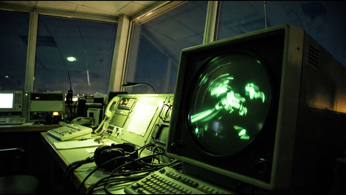
A single controller in a busy tower can be responsible for dozens of aircraft at once, each moving at hundreds of kilometers per hour, separated from one another by margins measured in mere kilometers. Making that work safely, hour after hour, depends on a tracking system built from two very different technologies layered on top of each other rather than any single all-seeing radar dish.
The popular image of air traffic control, a lone green blip sweeping across a dark screen, is only part of the real story. Since the 1960s, the system has quietly evolved into a hybrid that combines traditional radar reflections with aircraft actively broadcasting their own identity, altitude, and increasingly their exact GPS position, and understanding how those pieces fit together explains both why flying has become so remarkably safe and why a handful of aircraft still occasionally vanish from radar screens without warning.
This layered approach did not emerge all at once. It grew in stages, each one added to patch a specific weakness in what came before, and tracing those stages in order is the clearest way to understand why modern air traffic control looks the way it does today.
A Sky Full of Aircraft, One Screen
At any given moment, thousands of commercial aircraft are airborne worldwide, each one needing to be tracked continuously enough that controllers can keep it a safe distance from every other aircraft, terrain, and restricted airspace, all while air traffic control centers hand aircraft off to one another seamlessly as flights cross regional boundaries.
Achieving that level of continuous, reliable tracking across an entire flight, from taxiing at the gate to landing at a different airport hundreds or thousands of kilometers away, requires several overlapping systems rather than one, since no single sensor technology performs well in every phase of flight and every type of terrain a modern flight path crosses.
How Primary Radar Actually Works
Primary surveillance radar operates on the same basic physical principle radar has used since the Second World War: a rotating antenna sends out short, powerful pulses of radio energy, and whenever one of those pulses strikes a solid object, like the metal skin of an aircraft, some of that energy bounces back toward the antenna.
By measuring precisely how long the reflected pulse takes to return, the system calculates the aircraft's distance, and by tracking which direction the antenna was pointing at the moment of the strongest reflection, it calculates the aircraft's bearing, together producing a single dot of raw position data that a computer then plots and updates with each rotation of the antenna, typically every several seconds.
Why Primary Radar Alone Was Never Enough
Primary radar has a fundamental limitation baked into its design: it can tell controllers that something solid is out there and roughly where, but it cannot tell them what that something actually is, which specific flight it belongs to, or how high it is flying, since altitude cannot be reliably derived from a simple reflected pulse alone.
In airspace with dozens of aircraft converging from different directions and altitudes, an unlabeled dot on a screen is nearly useless for making safe separation decisions, which is exactly the gap that pushed aviation authorities to develop a second, cooperative surveillance system that would have aircraft actively identify themselves rather than relying purely on passive reflection.
The Transponder That Talks Back
Every commercial aircraft carries a transponder, a radio device that listens for an interrogation signal from a ground station and automatically replies with a coded response, a fundamentally different and far more informative approach than simply bouncing a radar pulse passively off the aircraft's metal frame.
The transponder's reply includes, at minimum, a unique aircraft identification code assigned for that specific flight, and modern transponders also transmit the aircraft's altitude as reported by its onboard instruments, information a controller's screen displays directly alongside the aircraft's position, instantly turning an anonymous dot into a labeled, identifiable flight with a known altitude.
What Secondary Surveillance Radar Adds
The ground-based system that interrogates transponders and processes their replies is called secondary surveillance radar, and it typically shares the same rotating antenna structure as the primary radar, sending out interrogation pulses in step with the primary sweep so that both position and identity data arrive together and get merged into a single track on the controller's display.
This combination, a passive reflection confirming something physical is present, paired with an active reply confirming exactly what it is, altitude, and identity, is what actually populates the labeled data blocks controllers watch, each one showing a flight number, altitude, and speed trend updating continuously as the aircraft moves through controlled airspace.
How ADS-B Changed the Picture Entirely
Automatic Dependent Surveillance-Broadcast, universally shortened to ADS-B, represents the most significant recent shift in how aircraft are tracked: rather than waiting to be interrogated by a ground radar station, an ADS-B-equipped aircraft determines its own precise position using GPS satellites and then broadcasts that position, along with velocity and altitude, continuously on its own, roughly once per second.
Because ADS-B broadcasts do not depend on a rotating ground antenna sweeping past the aircraft periodically, ground stations and even other properly equipped aircraft can receive and display an ADS-B aircraft's position far more frequently and with substantially better accuracy than traditional radar allows, which is why most major aviation authorities have made ADS-B equipment mandatory for aircraft flying in controlled airspace.
Why Some Aircraft Still Rely on Radar Only
Despite the clear advantages of ADS-B, older aircraft, smaller general aviation planes, military aircraft operating without broadcasting their position for security reasons, and aircraft in regions still transitioning their fleets all continue to rely at least partly on traditional secondary and even primary radar, which is why air traffic control systems worldwide are generally designed to blend multiple surveillance sources into one unified picture rather than depending on any single technology exclusively.
This blended approach also provides a valuable safety backstop, since if an aircraft's transponder or ADS-B equipment ever fails mid-flight, primary radar reflections alone can still give controllers at least a rough, anonymous track of the aircraft's position, better than losing all visibility of it entirely during a critical equipment malfunction.
How Controllers Actually Separate Aircraft Safely
Armed with continuously updating position, altitude, and identity data from this layered surveillance system, controllers apply standardized minimum separation rules, generally measured in both horizontal distance and vertical altitude difference, that vary depending on the type of airspace, the aircraft involved, and how closely spaced the surveillance data updates arrive.
Modern systems also include automated conflict-alert software that continuously projects each aircraft's current trajectory forward in time and flags to the controller, well before an actual violation of separation minimums would occur, any pair of aircraft whose projected paths are converging too closely, giving human controllers a crucial early warning layered on top of their own situational awareness.
What Happens When a Transponder Fails
When an aircraft's transponder stops responding, whether from an equipment fault or a pilot forgetting to activate it correctly after landing at an intermediate stop, controllers see the identifying data block on their screen either freeze, disappear, or degrade to a generic, unlabeled primary radar return, depending on exactly which layer of surveillance has failed.
Standard procedure in that situation has controllers immediately attempt to contact the flight by radio to confirm its status and instruct the crew to reset or manually re-enter transponder settings, while continuing to track the aircraft's raw position using whatever primary radar coverage remains available in that particular stretch of airspace until communication and proper identification are restored.
Radar Coverage Gaps Over Oceans and Deserts
Ground-based radar, whether primary or secondary, has a fundamentally limited range and requires a network of stations to provide continuous coverage, which becomes economically and physically impractical over vast oceans, remote deserts, and polar regions far from any populated area where a radar installation would make sense to build and maintain.
In these radar-shadow regions, controllers have historically relied on periodic radio position reports from pilots rather than continuous surveillance, a gap that satellite-based ADS-B reception, receiving aircraft broadcasts directly via satellite rather than a ground antenna, has begun closing meaningfully over the past decade, extending genuine real-time tracking to stretches of airspace that radar coverage alone could never economically reach.
Why the Gulf Built Some of the World's Busiest Airspace Monitoring
The UAE, Saudi Arabia, and Qatar sit at the crossroads of major long-haul air corridors linking Europe, Asia, and Africa, and their airports rank among the busiest transit hubs anywhere, which has pushed regional aviation authorities to invest heavily in dense radar networks alongside early, aggressive adoption of ADS-B and satellite-based surveillance to manage the sheer volume of overlapping long-haul traffic passing through and over the region every hour.
Dubai's air traffic control system in particular has to coordinate extraordinarily tight arrival and departure sequencing given the airport's traffic volume, which is part of why Gulf aviation authorities were early, active participants in international efforts to modernize surveillance standards well ahead of many other regions with comparably busy but more geographically dispersed air traffic.
What a Radar Screen Actually Shows a Controller
What a controller actually watches is not the raw sweep of a rotating antenna, since that would be far too slow and cluttered to work with directly; instead, a computer processing system fuses primary returns, secondary radar replies, and ADS-B broadcasts into a single smoothed, continuously updating display where each aircraft appears as one clean symbol with a data block attached, rather than a blinking dot that only refreshes once per antenna rotation.
That data block typically shows the flight number, current altitude, a short-term ground speed trend, and sometimes the aircraft type, all automatically generated from the underlying surveillance feeds rather than typed in manually, which is what allows a single controller to track dozens of aircraft simultaneously without needing to mentally reconstruct each one's identity from a raw radar return every few seconds.
Why Weather Radar Is a Separate System Entirely
It is easy to conflate air traffic control radar with the weather radar shown on flight-tracking apps and news broadcasts, but the two serve entirely different purposes and often use different equipment: weather radar is tuned to detect precipitation and turbulence-associated moisture in the atmosphere, while air traffic surveillance radar is tuned to detect solid metal objects and largely treats rain and clouds as unwanted background clutter to be filtered out.
Modern air traffic control systems do still incorporate weather radar data onto the same displays controllers use, since storms directly affect which routes and altitudes are safe to fly, but that weather picture is a separate data layer overlaid on top of aircraft surveillance rather than a byproduct of the same radar pulses used to track the planes themselves.
How Military and Civilian Radar Data Sometimes Overlap
Military radar networks generally operate independently of civilian air traffic control, often with more sensitive equipment capable of detecting aircraft that deliberately avoid broadcasting a civilian transponder signal, but in many countries the two systems share selected data through formal agreements, particularly around shared airspace, major international airports, and security-sensitive border regions.
This overlap matters most in moments of equipment failure or unusual flight behavior, when civilian controllers may lose a clear track on an aircraft and military radar coverage, often denser and less dependent on cooperative signals like transponders, can help re-establish where a specific aircraft actually is until normal civilian surveillance data resumes.
How Controllers Are Trained to Trust the System — and Question It
Air traffic controllers spend years training not just to read a radar and ADS-B fused display correctly, but to recognize when the underlying data itself might be wrong, since a surveillance system built from multiple overlapping sensors can occasionally produce a false or duplicate track, a momentary dropout, or a mismatch between an aircraft's reported altitude and its actual behavior that a purely automated system might miss.
Simulator training deliberately introduces these edge cases, equipment glitches, conflicting data from two surveillance sources, a transponder reporting an altitude that does not match a visual pilot report, precisely so controllers build the judgment to fall back on radio communication and procedural rules rather than blindly trusting a display that is, in the end, still an approximation built from imperfect sensors.
What Passengers Actually See on Flight-Tracking Apps
The flight-tracking apps and websites many travelers check before a trip generally do not have direct access to official air traffic control radar feeds at all; instead, most of them rely on publicly receivable ADS-B broadcasts picked up by a global network of amateur and commercial ground receivers, then aggregated and displayed with a short delay.
This explains a few quirks frequent flyers notice, such as an aircraft appearing to vanish briefly over a remote ocean stretch or mountainous region where ground-based ADS-B receiver coverage is thin, even though the aircraft itself was never actually lost from view by official air traffic control, which increasingly also receives that same broadcast via satellite relay even where ground receivers cannot reach.
Why a Handful of High-Profile Cases Still Went Untracked
Rare but widely reported incidents in which an aircraft's position became genuinely unknown for an extended period have generally involved a specific, unlucky combination of factors: flying over a radar coverage gap far from land, a transponder and other tracking equipment being disabled or failing simultaneously, and the incident occurring before satellite-based ADS-B reception had been fully rolled out across that particular stretch of airspace.
These incidents, though statistically rare against the enormous volume of safely tracked flights every single day, directly accelerated international efforts to mandate more robust, satellite-independent tracking equipment on commercial aircraft, closing exactly the kind of coverage and equipment-failure gap that made such cases possible in the first place.
Where Aircraft Tracking Is Headed Next
Aviation authorities are steadily working toward relying primarily on satellite-based ADS-B and similar cooperative surveillance technologies, using traditional ground radar increasingly as a backup and verification layer rather than the primary tracking method, a shift that promises tighter safe-separation margins and more efficient flight routing since aircraft position becomes known with far greater precision and update frequency than rotating ground antennas could ever provide.
That transition will take years to complete fully given the enormous installed base of older aircraft and ground infrastructure still in active service worldwide, but the direction is clear: air traffic control is steadily moving away from passively watching the sky and toward a system where aircraft themselves are constantly, precisely telling the ground exactly where they are.
Sources
- Wikipedia — overview of air traffic control systems and surveillance methods
- U.S. Federal Aviation Administration — technical background on radar and ADS-B surveillance standards
- International Civil Aviation Organization — global standards for air traffic surveillance and separation
- UAE General Civil Aviation Authority — regional aviation safety and airspace oversight information
FAQ
Can radar tell how high a plane is flying?
Primary radar alone generally cannot determine altitude reliably; that information comes from the aircraft’s transponder, which reports its own onboard altitude reading directly to secondary surveillance radar and to ADS-B receivers on the ground.
What is the difference between radar and ADS-B?
Radar is a ground-based system that detects aircraft by sending out pulses and measuring reflections, while ADS-B has the aircraft itself determine its GPS position and broadcast it continuously, generally producing more frequent and more accurate tracking data.
What happens if a plane’s transponder stops working?
Controllers immediately try to contact the crew by radio, continue tracking the aircraft using any available primary radar coverage, and instruct the pilots to reset or manually re-enter the transponder settings until proper identification is restored.
Why do planes sometimes disappear from radar over oceans?
Ground-based radar has limited range and cannot economically cover vast, sparsely populated regions like oceans and deserts, though satellite-based ADS-B reception has substantially closed this tracking gap over the past decade.
Why did Gulf airports invest so heavily in surveillance technology?
The UAE, Saudi Arabia, and Qatar sit along major long-haul air corridors between Europe, Asia, and Africa, and their airports handle extremely high transit traffic volumes, which pushed early, aggressive adoption of dense radar and ADS-B networks.
About the Author
We reference Wikipedia and other authoritative sources to explain the background and current understanding of this topic.
Loved This Article?
Share it on WhatsApp → Share it on WhatsApp
Get more guides in your inbox — Subscribe to our newsletter for weekly surprising stories from Egypt, Saudi Arabia, Dubai, and beyond.