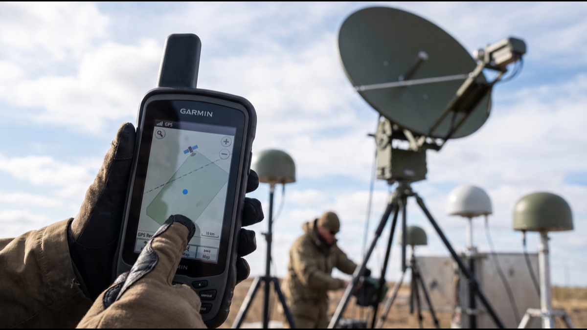
The satellites have no idea where you are. They receive nothing, track nobody, and broadcast identically whether a billion devices are listening or none at all. Everything is computed by the receiver from signals that are sent regardless.
What those signals actually contain is time, meaning the precise moment of transmission and the satellite's position at that moment. Position is derived entirely from timing, which is why atomic clocks are central, why relativity has to be corrected for daily, and why an inexpensive phone ends up knowing the time to within billionths of a second as a side effect of working out where it is.
What a Satellite Actually Transmits
Each satellite continuously broadcasts a signal containing the precise time it was sent and information describing exactly where the satellite was at that moment.
It does not know where the receiver is, does not receive anything from it, and would broadcast identically if nobody were listening at all.
This is why an unlimited number of devices can use the system simultaneously without degrading it, since the satellites are not tracking anyone.
How Distance Is Measured From Time
The receiver compares the time encoded in the signal with its own clock, and the difference multiplied by the speed of light gives the distance travelled.
Because radio waves travel roughly thirty centimetres per nanosecond, timing errors translate directly into position errors at a punishing rate.
This is why the entire system is fundamentally a timing problem rather than a positioning one, and why atomic clocks are central to it.
Why Three Satellites Are Not Enough
Knowing the distance to three satellites would in principle fix a position by intersecting three spheres, which sounds sufficient.
The difficulty is that the receiver's own clock is far too imprecise to measure the travel times accurately, introducing an unknown offset into every measurement.
A fourth satellite provides the additional equation needed to solve for that clock error alongside position, which is why four is the practical minimum.
How Receivers Get Atomic Precision Without Atomic Clocks
Solving for the clock offset means the receiver effectively calibrates its inexpensive crystal oscillator against the satellites' atomic clocks continuously.
This is a genuinely elegant consequence, since a device costing very little ends up knowing the time to within billionths of a second.
It is why satellite navigation is used as a global time reference by telecommunications networks, financial systems and power grids that never need position at all.
Why Relativity Actually Matters
Satellite clocks run slower than ground clocks because of their orbital speed, and faster because they sit higher in Earth's gravitational field.
The gravitational effect is larger, so the net result is that satellite clocks gain time relative to the surface by a small but consequential amount each day.
Uncorrected, this would introduce position errors accumulating to kilometres within a day, which makes satellite navigation the most familiar practical application of relativity.
How the Correction Is Applied
Satellite clocks are deliberately set to run at a slightly offset rate before launch, so that once in orbit they tick at the correct rate as seen from the ground.
Additional corrections handle the fact that orbits are not perfectly circular, since altitude and speed vary slightly through each orbit.
These corrections are built into the broadcast data, meaning receivers apply them without needing to model relativity themselves.
Why the Atmosphere Introduces Errors
Signals slow slightly when passing through the ionosphere and troposphere, and since the system infers distance from travel time, any delay appears as extra distance.
Ionospheric delay varies with solar activity and time of day and is the largest single error source in standard positioning.
Receivers using two frequencies can measure and cancel this delay directly, because the effect differs between frequencies in a predictable way.
What Multipath Does in Cities
Signals reflecting off buildings arrive later than the direct path, and a receiver that cannot distinguish them measures an artificially long distance.
This is why accuracy degrades sharply in dense urban areas, sometimes placing a device on the wrong street entirely despite good satellite visibility.
Modern receivers mitigate this by analysing signal characteristics and by combining satellite data with sensors that detect motion independently.
How Augmentation Systems Improve Accuracy
Ground stations at precisely known locations measure the error in received signals and broadcast corrections that nearby receivers can apply.
Because most error sources are similar across a region, a correction computed at one location substantially improves accuracy for users tens of kilometres away.
This is what enables centimetre-level positioning in surveying and agriculture, using the same satellites that give a phone several metres.
Why Assisted Positioning Made Phones Fast
A receiver starting without information must search for satellites and download orbital data, which historically took minutes before a first position appeared.
Phones shortcut this by downloading the same data over the mobile network in seconds, and by using cell tower location to narrow the search.
This is why a phone locates almost instantly while a dedicated device sometimes takes considerably longer, despite the underlying receiver being similar.
What Other Constellations Added
Several countries operate independent systems, and modern receivers use all of them together rather than choosing one.
More satellites means more are visible at once, which improves accuracy and substantially helps in cities where buildings block much of the sky.
It also removes dependence on any single operator, which was a significant motivation for building alternatives to the original system.
Why Selective Availability Was Removed
The original system deliberately degraded civilian accuracy for security reasons, limiting it to roughly a hundred metres while military users received full precision.
This was switched off permanently, partly because augmentation systems had made the degradation easy to circumvent and partly because civilian value had become obvious.
Civilian accuracy improved by an order of magnitude overnight, which is a substantial part of why consumer navigation became practical when it did.
How Jamming and Spoofing Work
Satellite signals arriving at the surface are extraordinarily weak, which makes them easy to overwhelm with a low-power transmitter nearby.
Jamming denies service, while spoofing is more serious, transmitting false signals that cause a receiver to compute a confidently wrong position.
Incidents affecting aviation and shipping have increased substantially, which has renewed interest in terrestrial backup systems that were previously being decommissioned.
Why Backup Systems Are Returning
Because so much infrastructure depends on satellite timing, a prolonged outage would affect far more than navigation, including financial transactions and grid synchronisation.
Ground-based long-range timing systems that were being retired are being reconsidered, since they are difficult to jam over wide areas and independent of space.
This reflects a broader recognition that a single point of failure serving critical infrastructure is unwise regardless of how reliable it has been.
How Receivers Work Indoors
Satellite signals do not penetrate buildings reliably, so phones fall back on identifying nearby wireless networks whose locations have been previously mapped.
This database was built by devices reporting which networks they observed alongside a satellite-derived position, which is why coverage is best where people already go.
The result is that indoor positioning frequently works well without any satellite signal, using infrastructure never designed for that purpose.
What Dead Reckoning Contributes
Accelerometers, gyroscopes and compasses let a device estimate movement independently, which fills gaps when signals are lost in tunnels or urban canyons.
These sensors drift quickly, so they cannot substitute for satellite positioning, but they are excellent over short intervals between updates.
Combining both is why navigation continues smoothly through a tunnel rather than freezing, and why a map follows a turn immediately rather than lagging.
Why Altitude Is Less Accurate Than Position
Vertical accuracy is typically several times worse than horizontal, because all visible satellites are above the receiver rather than distributed around it.
This geometric limitation cannot be solved by better receivers, since the problem is where the satellites are rather than how well signals are measured.
Devices requiring accurate altitude generally use a barometric sensor instead, calibrated against satellite altitude when conditions allow.
How Timing Serves Infrastructure
Mobile networks require base stations to be synchronised extremely precisely, and satellite timing is the standard way this is achieved across a country.
Financial regulations in several jurisdictions require transaction timestamps accurate to fractions of a millisecond, which in practice means satellite-derived time.
Power grids use it to compare measurements across large distances, which is essential for detecting instability before it becomes a cascading failure.
Why Orbits Were Chosen as They Are
Satellites sit in medium orbit, high enough that a modest number covers the entire planet continuously and low enough that signal strength remains workable.
Geostationary orbit would allow fixed positions in the sky but provides poor coverage at high latitudes and worse geometry for position calculation.
Low orbit would need far more satellites, though several proposals now suggest using large low-orbit constellations to supplement existing systems.
What Happens When a Satellite Fails
Constellations include spares, and the ground segment can reposition satellites or bring reserves into service, though this takes time.
Individual failures degrade accuracy in specific regions rather than causing outages, since receivers simply use whichever satellites remain visible.
The system was designed for graceful degradation, which is why it has never suffered a complete failure despite continuous partial ones.
How Accurate It Actually Is
A typical phone achieves several metres in open conditions, degrading substantially among buildings and improving with corrections to well under a metre.
Survey equipment using augmentation and extended observation achieves centimetres, which is sufficient for construction and precision agriculture.
The limiting factor for consumers is almost always the environment rather than the receiver, which is why accuracy varies so much within a single journey.
Why Maps Sometimes Disagree With Position
A position can be perfectly accurate while appearing wrong because the underlying map is outdated or was surveyed to a different reference frame.
Continental drift moves landmasses by centimetres annually, and some countries have updated their coordinate reference frames specifically to account for accumulated movement.
This means an apparent error may lie in the map rather than the positioning, which matters increasingly as consumer accuracy improves.
What Privacy Actually Depends On
Receivers are passive and transmit nothing, so satellite navigation alone cannot track anyone, which is a common misunderstanding worth correcting.
Tracking occurs when a device transmits its computed position elsewhere, which is a function of applications and networks rather than of the satellites.
The distinction matters practically, since disabling location services affects what applications receive rather than what the receiver itself can determine.
What the System Actually Is
Satellite navigation is a global clock broadcast that happens to enable positioning, rather than a positioning system that happens to use time.
This framing explains why relativity matters, why timing infrastructure depends on it, and why receivers end up with atomic-grade time as a by-product.
It also explains its fragility, since the same weak signals that make the system universally available make it straightforward to disrupt locally.
Why the System Was Built for the Military
Satellite navigation was developed to let submarines, aircraft and missiles establish position precisely anywhere on the planet without relying on ground infrastructure.
Civilian access was permitted after a passenger aircraft was shot down having strayed off course, which made accurate public navigation a stated policy goal.
The system remains operated by military organisations in every country that fields one, which is a structural fact behind ongoing efforts to build independent alternatives.
How Ground Control Keeps It Accurate
A network of monitoring stations continuously tracks every satellite, measuring its actual orbit and clock behaviour against prediction.
Corrections are uploaded regularly so each satellite broadcasts accurate information about where it is, since orbits drift under gravitational influences.
Without this constant maintenance, accuracy would degrade within days, which means the visible space segment depends entirely on an invisible ground operation.
Why Orbits Drift at All
Satellites are perturbed by the Moon and Sun, by the fact that Earth is not a perfect sphere, and by pressure from sunlight itself.
These influences are small but accumulate, meaning a predicted orbit becomes measurably wrong over hours rather than months.
Modelling them accurately is a substantial part of what determines system accuracy, and improvements here have contributed as much as better receivers have.
What Carrier Phase Tracking Adds
Beyond decoding the signal's content, a receiver can track the phase of the underlying radio wave, which is measurable to a tiny fraction of a wavelength.
This offers far greater precision than timing alone, but introduces an ambiguity about how many whole wavelengths lie between satellite and receiver.
Resolving that ambiguity is what allows centimetre positioning, and it requires either extended observation or corrections from a nearby reference station.
Why Cold Starts Take So Long
A receiver with no stored data must search across possible satellites and frequency offsets simultaneously, which is computationally demanding.
It then needs to download orbital information broadcast slowly within the signal itself, which takes a fixed period regardless of processor speed.
This is why a device left unused for months behaves differently from one used yesterday, since stored data becomes stale and the search must begin again.
How Speed Is Actually Measured
Velocity is not calculated by comparing successive positions, which would be imprecise, but from the Doppler shift in the received signal frequency.
This gives speed considerably more accurately than position, which is why a device can report velocity confidently while its position wanders.
It also explains why speed readings settle quickly after signal reacquisition while position may take longer to stabilise.
Why Wearables Struggle More
Small devices have compact antennas with poor reception characteristics, and they are worn against a body that blocks a substantial portion of the sky.
Arm movement also changes antenna orientation continuously, which makes tracking harder than it is for a device held steady or mounted in a vehicle.
This is why distance measurements from wrist devices vary noticeably between products, and why they typically combine satellite data with motion sensors.
Why Navigation Apps Differ From Raw Position
A raw computed position frequently falls slightly off the road, so navigation software snaps it to the nearest plausible route rather than displaying it literally.
This map matching is why a route appears to follow the road perfectly even when underlying accuracy is several metres, which conceals how variable the raw data is.
It occasionally fails on parallel roads or multi-level junctions, where the wrong candidate is chosen and the display confidently shows a position on the wrong carriageway.
Satellite navigation is a clock broadcast that happens to enable positioning, not the other way round. Satellites transmit the precise time of transmission and where they were at that moment; they receive nothing and track nobody. Distance comes from comparing that timestamp against the receiver's own clock, which is why the whole thing is fundamentally a timing problem. That framing explains the details that otherwise seem arbitrary. Four satellites are needed rather than three because the receiver's inexpensive clock is far too imprecise, so its error has to be solved for alongside position — which incidentally leaves the device knowing the time to within billionths of a second, and is why telecoms networks, financial systems and power grids depend on satellite timing without ever needing a position. It also explains why relativity is not a curiosity here. Satellite clocks gain time relative to the ground because the gravitational effect exceeds the velocity one, and uncorrected this would produce position errors accumulating to kilometres within a day. And it explains the fragility: signals arriving from orbit are extraordinarily weak, so a low-power transmitter can drown them locally — which is why terrestrial backup systems that were being decommissioned are now being reconsidered.
Sources
- Wikipedia — system architecture, constellations and error sources
- US Space Force — official system status, accuracy and selective availability history
- European Space Agency — Galileo constellation and augmentation systems
- National Institute of Standards and Technology — timing standards and infrastructure dependence on satellite time
- International Civil Aviation Organization — reporting on jamming and spoofing incidents affecting aviation
FAQ
Do satellites track my location?
No. Receivers are passive and transmit nothing to the satellites. Tracking happens only when your device sends its computed position elsewhere, which is an app and network function.
Why are four satellites needed, not three?
Three would fix a position if the receiver's clock were accurate. It is not, so a fourth measurement is needed to solve for the clock error alongside position.
Does relativity really affect satellite navigation?
Yes. Satellite clocks gain time relative to the ground each day, and without correction position errors would accumulate to kilometres within a day.
Why is accuracy so bad between tall buildings?
Signals reflect off buildings and arrive late, so the receiver measures an artificially long distance. Fewer satellites are also visible, worsening the geometry.
Why does my phone locate faster than a dedicated device?
It downloads satellite orbital data over the mobile network in seconds rather than waiting to receive it from the satellites, and uses cell towers to narrow the search.
About the Author
We reference Wikipedia, US Space Force, European Space Agency, National Institute of Standards and Technology, and International Civil Aviation Organization to explain the background and current understanding of this topic.
Loved This Article?
Share it on WhatsApp → Share it on WhatsApp
Get more guides in your inbox — Subscribe to our newsletter for weekly surprising stories from Egypt, Saudi Arabia, Dubai, and beyond.