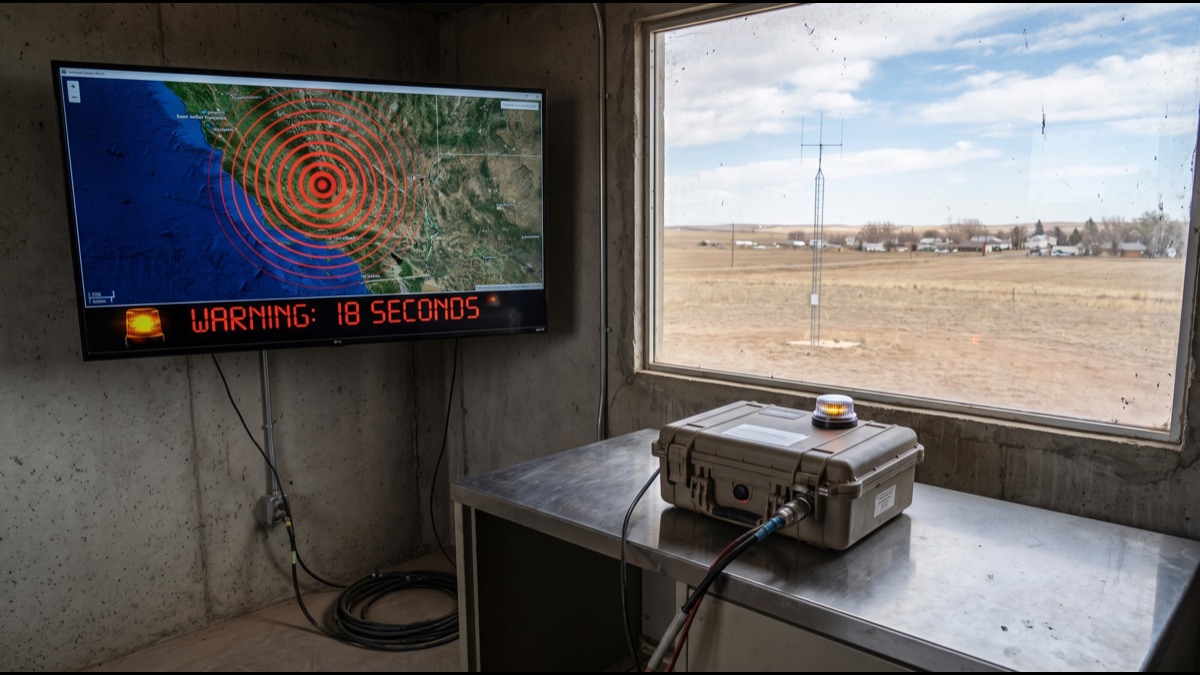
Seismologists have never successfully predicted a specific earthquake days or hours in advance, and most experts believe reliable long-term prediction may never be possible. Yet in Japan, Mexico, and increasingly the western United States, millions of phones now buzz with a warning seconds before the shaking from a major earthquake actually arrives.
This is not prediction in the traditional sense at all. It is detection, exploiting a basic and genuinely elegant fact about how seismic energy travels through the earth, and understanding that distinction explains both what these systems can realistically promise and why they cannot help everyone equally.
Why Early Warning Is Possible Despite Not Predicting Earthquakes
An earthquake begins at a single point underground called the hypocenter, releasing energy that radiates outward in multiple types of waves traveling at different speeds, and it is this speed difference, not any advance knowledge of the quake itself, that early warning systems exploit.
The system does not know an earthquake is coming before it starts; it detects the earthquake within moments of it actually beginning and then races the resulting information, traveling nearly at the speed of light through fiber and radio networks, against the physically slower destructive shaking still travelling through rock.
How P-Waves and S-Waves Actually Differ in Speed
Every earthquake generates primary waves, commonly called P-waves, which travel fastest through rock but carry relatively little destructive energy, arriving first at any given location as a subtle initial jolt that many people barely notice.
Secondary waves, called S-waves, travel considerably slower but carry the bulk of an earthquake's destructive shaking, meaning there is a genuine window of several seconds to tens of seconds between the harmless early signal and the arrival of the dangerous shaking itself.
How Seismic Sensor Networks Actually Detect the First Waves
Dense networks of seismometers positioned across earthquake-prone regions continuously monitor ground motion, and specialized detection algorithms are tuned specifically to recognize the distinctive signature of a P-wave within a second or two of it reaching the nearest sensors.
Multiple sensors reporting a consistent pattern within a short time window allow the system to confirm a genuine earthquake is underway rather than a passing truck or minor local disturbance, a confirmation step that must happen extremely quickly without sacrificing meaningful accuracy.
How the System Estimates Magnitude Before the Quake Fully Unfolds
Modern warning systems estimate an earthquake's likely magnitude and location using only the first few seconds of P-wave data from the nearest handful of sensors, a genuinely difficult estimation problem since the full rupture may still be actively growing underground.
As additional sensor data arrives in the following seconds, the system continuously refines its magnitude and shaking-intensity estimate, sometimes issuing updated alerts that raise or lower the expected severity for specific areas as the picture becomes clearer.
How Warnings Are Actually Distributed to the Public in Seconds
Once a warning is generated, it must reach potentially millions of phones, televisions, and automated industrial systems within a handful of seconds, which requires dedicated low-latency distribution infrastructure rather than relying on ordinary internet or cellular traffic that can experience unpredictable delays.
Many systems use cell broadcast technology, which pushes a message simultaneously to every compatible phone within a geographic area at once, rather than sending individual messages to each device, a method chosen specifically because it scales instantly regardless of how many phones are in the affected zone.
Why Warning Time Varies So Dramatically by Distance
Locations close to the earthquake's epicenter may receive only a few seconds of warning or none at all, since the destructive S-wave arrives almost immediately after the initial detection, leaving little to no time for the alert to be processed and distributed.
Locations considerably farther from the epicenter can receive tens of seconds of genuine warning, since the widening gap between the fast-traveling detection signal and the slower physical shaking grows with distance, which is precisely why these systems are most useful for populations somewhat removed from the fault itself.
How Automated Systems Trigger Safety Actions Without Human Intervention
Beyond alerting people directly, warning signals are increasingly wired directly into automated infrastructure, triggering high-speed trains to begin braking, elevators to stop at the nearest floor and open their doors, and gas lines at industrial facilities to shut valves automatically within a fraction of a second of receiving the signal.
These automated responses matter enormously because they require no human decision-making under time pressure, and because machines can react measurably faster and more consistently than any person could manage in the handful of seconds typically available.
Why False Alarms and Missed Alerts Still Genuinely Happen
Early warning systems occasionally issue alerts for earthquakes that turn out to be far weaker than initially estimated, a consequence of making rapid magnitude estimates from limited early data, and repeated false alarms risk eroding public trust in the system over time.
The opposite failure, a genuinely damaging earthquake generating an inadequate or delayed alert, can happen when the rupture begins in a way that confuses the early detection algorithms or when sensor coverage in the affected area is genuinely sparse, both scenarios that system designers continuously work to reduce.
How Japan Built the World's Most Mature Warning System
Japan's dense national seismometer network, developed over decades following repeated catastrophic earthquakes, feeds a highly refined warning system integrated directly into television broadcasts, smartphone operating systems, train networks, and factory automation across the entire country.
The system's maturity reflects both Japan's sustained public investment in seismic monitoring infrastructure and decades of genuine operational experience refining detection algorithms after real earthquakes, including painful lessons learned from missed or delayed warnings during past major events.
How Mexico's System Pioneered Early Warning for the Americas
Mexico developed one of the world's earliest operational earthquake warning systems following the devastating 1985 Mexico City earthquake, taking particular advantage of the fact that many of the country's most damaging earthquakes originate offshore, providing the capital city with a genuinely useful warning window of tens of seconds.
That system has since been refined repeatedly and remains a frequently cited model for how a geographically fortunate combination of offshore fault lines and a concentrated inland population center can make early warning especially effective for a specific city.
How the US West Coast ShakeAlert System Actually Works
The United States operates ShakeAlert along its West Coast, a system built on a growing network of seismic sensors across California, Oregon, and Washington, delivering alerts through dedicated smartphone apps, wireless emergency alerts, and integration with select transit and utility infrastructure.
ShakeAlert took considerably longer to reach full public deployment than Japan's or Mexico's systems, reflecting both the scale of building sufficient sensor density across a large and geologically varied region and the complexity of coordinating multiple state governments and private infrastructure operators.
Why Some Earthquake-Prone Regions Still Lack Any Warning System
Building an effective warning system requires substantial upfront investment in dense sensor networks, reliable low-latency communication infrastructure, and sustained institutional commitment over many years, resources that many earthquake-prone but lower-income regions simply have not yet been able to commit at the necessary scale.
Several international development and scientific organizations have begun supporting lower-cost sensor technology and simplified system designs specifically aimed at making basic early warning capability more achievable for regions that cannot yet afford systems as comprehensive as Japan's or the United States'.
How Warning Systems Genuinely Differ From Earthquake Prediction
Prediction would mean knowing an earthquake will occur at a specific time and place before it begins, something no scientific method has ever reliably achieved despite decades of dedicated research effort across multiple countries and research institutions.
Early warning instead only requires detecting an earthquake that has already begun, an achievable engineering problem rather than the unsolved scientific problem of prediction, which is precisely why warning systems have become operationally viable while reliable prediction has not.
How Smartphones Have Turned Into Makeshift Sensor Networks
Modern smartphones contain accelerometers originally included for screen rotation and step counting, and several warning systems now aggregate anonymized motion data from large numbers of phones to supplement or even substitute for traditional dedicated seismometer networks in regions lacking dense official infrastructure.
This crowdsourced approach trades some precision compared to purpose-built scientific instruments for dramatically wider geographic coverage at minimal additional infrastructure cost, an approach that has allowed several countries to extend at least basic warning coverage faster than building traditional sensor networks alone would have allowed.
What Actually Happens Inside a Building When an Alert Arrives
Public safety guidance consistently emphasizes the same core action during the warning window, commonly summarized as drop, cover, and hold on, since these seconds are best used seeking immediate physical protection rather than attempting to evacuate a building while the ground is actively moving.
Automated building systems increasingly use the same warning signal to unlock stairwell doors, halt escalators, and pause manufacturing equipment handling hazardous materials, extending the benefit of those precious seconds beyond what any individual occupant could accomplish through personal action alone.
How Warning Systems Integrate With Trains, Elevators, and Factories
High-speed rail operators in several countries have wired warning signals directly into train control systems, automatically initiating emergency braking the instant an alert is received, since a train travelling at high speed benefits enormously from even a few extra seconds of braking distance before shaking reaches the track.
Industrial facilities handling hazardous chemicals or precision manufacturing processes similarly use warning signals to trigger automatic shutdown sequences, protecting both worker safety and expensive equipment from damage that violent unexpected shaking could otherwise cause during an active industrial process.
How Much a Few Seconds of Warning Actually Saves
Research following real earthquake events in Japan and Mexico has documented measurable reductions in injuries specifically attributable to people taking protective action during the warning window, along with clear operational benefits like trains stopping safely before derailing and factories avoiding equipment damage.
Even a warning of only a few seconds has repeatedly proven sufficient for the specific automated actions that matter most, including halting trains, opening elevator doors, and triggering safety shutoffs, even when that same brief window is too short for most people to physically relocate to a safer position.
What the Next Generation of Earthquake Warning Systems Looks Like
Researchers are actively working on shortening the critical detection-to-alert latency even further through improved sensor placement, faster algorithms, and tighter integration with existing telecommunications infrastructure, since every additional second of genuine warning meaningfully increases what protective action becomes possible.
Growing international collaboration is also focused on sharing lower-cost sensor and software designs with earthquake-prone regions that currently lack any warning capability at all, aiming to make at least a basic version of this technology available considerably more broadly than it is today.
How Warning Challenges Differ Between Coastal and Inland Earthquakes
Offshore earthquakes often originate in subduction zones where an oceanic plate slides beneath a continental one, a geometry that frequently places natural distance between the rupture point and coastal population centers, giving warning systems a longer effective window to operate within.
Earthquakes occurring directly beneath an inland city lack this natural geographic buffer, making it considerably harder to build genuinely useful warning capability for such areas, since it demands denser sensor coverage and faster algorithms specifically to shrink the unavoidable detection latency as much as possible.
How Seismic Sensor Networks Are Actually Funded and Maintained Long-Term
Maintaining a national seismic sensor network requires ongoing operational investment that considerably exceeds the initial installation cost, since equipment needs periodic calibration, periodic replacement, and protection against environmental and electrical failures across decades of continuous service.
Many countries rely on a mix of direct government funding, international grants, and academic research partnerships to keep these networks operating, since even a temporary funding interruption can leave dangerous coverage gaps that take years to fully repair afterward.
How Governments Actually Test Readiness Before Fully Trusting a System
Before full public launch, early warning systems typically undergo years of silent trial operation, generating internal alerts that are compared against actual subsequent seismic data without ever being sent to the public, allowing engineers to tune algorithms and reduce the false-alarm rate before risking public trust.
Some regions also run periodic simulated drills involving schools, government offices, and private companies, rehearsing receipt of a genuine alert and the appropriate protective response, specifically to confirm that actual human reaction during a real earthquake will be fast enough to make use of the brief warning window.
How the System Handles Multiple Earthquakes Occurring Close Together
When aftershocks or separate earthquakes strike a nearby area within a short time window, the system must quickly distinguish each event from the other to avoid mixing seismic wave data from two distinct earthquakes into one misleading magnitude estimate.
Specialized temporal and spatial filtering algorithms are applied to separate these overlapping events, an additional engineering problem that grew in importance after analyzing data from major earthquake sequences that produced dozens of strong aftershocks within just days of the main shock.
How Preparedness Culture Differs Between Mature and New Warning Systems
In societies like Japan, where early warning has been an established part of daily life for decades, people respond to the distinctive alert sound almost automatically, taking protective action with little hesitation thanks to repeated training that begins in childhood at school.
In regions where early warning was introduced comparatively recently, public awareness and genuine understanding of how to react to an alert remains a challenge entirely separate from the technical challenge of building the system itself, and building that trust and community habit typically takes additional years even after the system is technically launched.
Why Regional Cooperation Between Neighboring Countries Still Matters
Seismic faults do not respect political borders, meaning an earthquake originating in one country can seriously threaten a neighboring one, which is why several regions now pursue sharing sensor data and alert protocols across national borders to extend effective coverage for everyone involved.
Such cross-border arrangements face additional political and technical challenges beyond building a single national system, including standardizing data formats and ensuring continuous joint funding, but they remain genuinely necessary for regions where multiple countries share the same active seismic fault system.
Sources
- Wikipedia — overview of earthquake early warning technology and deployed systems worldwide
- United States Geological Survey — official data and research on ShakeAlert and seismic monitoring
- Japan Meteorological Agency — operator of Japan's national earthquake early warning system
- UNESCO — international efforts supporting disaster risk reduction and early warning systems
- U.S. Agency for International Development — development support for disaster preparedness infrastructure in vulnerable regions
FAQ
Can earthquake warning systems predict when an earthquake will happen?
No, they detect an earthquake within moments of it already beginning and race that information to distant locations faster than the destructive shaking itself travels; nothing is predicted in advance.
Why do people near the epicenter get little or no warning?
The destructive shaking arrives at nearby locations almost immediately after the earthquake begins, leaving too little time for detection and alert distribution to outrun it.
How much warning time is typical?
Warning times range from essentially zero near the epicenter to tens of seconds at greater distances, with the exact amount depending heavily on the earthquake's location and the region's sensor network.
Do all earthquake-prone countries have warning systems?
No, effective systems require substantial sustained investment in sensor networks and communication infrastructure, which many earthquake-prone but lower-income regions have not yet been able to fully build.
Can a smartphone alone detect earthquakes accurately?
Individual phones are less precise than dedicated seismometers, but aggregating motion data from many phones can meaningfully supplement or extend coverage in regions lacking dense traditional sensor networks.
About the Author
We reference Wikipedia, United States Geological Survey, Japan Meteorological Agency, UNESCO, and U.S. Agency for International Development to explain the background and current understanding of this topic.
Loved This Article?
Share it on WhatsApp → Share it on WhatsApp
Get more guides in your inbox — Subscribe to our newsletter for weekly surprising stories from Egypt, Saudi Arabia, Dubai, and beyond.