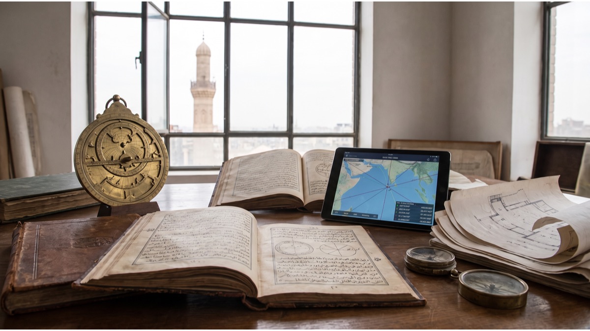
Point a smartphone qibla app anywhere on Earth and it will draw a single confident line toward Mecca. That confidence hides a genuinely interesting piece of applied mathematics: the direction it calculates is almost never the same as the straight line a person would draw on a normal world map, and the reason has nothing to do with religion and everything to do with the fact that the Earth is a sphere, not a sheet of paper.
Understanding how the qibla is actually calculated — historically and today — explains why old mosques sometimes point in slightly different directions than a modern app suggests, why the calculation behaves strangely near the poles, and why two qibla apps on the same phone can occasionally disagree by a couple of degrees.
What "Qibla" Actually Means
Qibla refers to the direction Muslims face during the five daily prayers, oriented toward the Kaaba, a cube-shaped structure inside the Grand Mosque in Mecca, Saudi Arabia. It is not a religious abstraction but a specific physical bearing calculated from wherever the worshipper happens to be standing, which means the actual compass direction is different in Jakarta than it is in London or New York.
Mosques encode this bearing permanently into their architecture through the mihrab, a niche set into the wall facing the qibla, so that the direction is fixed for the building and does not need to be recalculated at every prayer. Individual worshippers praying outside a mosque, however, need some way to determine that direction themselves, which is the actual practical problem this article is about.
Why a Straight Line on a Flat Map Gives the Wrong Direction
Most people's intuitive sense of direction comes from looking at a flat world map, tracing a straight line from their location to Mecca, and reading off the compass bearing that line appears to follow. For most of the widely used map projections, including the common Mercator-style projections seen in classrooms and on phone screens, this intuition is systematically wrong.
Flat maps distort a curved surface, and that distortion specifically bends what should be straight lines of shortest travel. A straight-looking line on a flat map is, in reality, a longer and differently oriented path than the true shortest route between two points on a sphere, and the amount of distortion grows the further the two points are apart and the closer either one is to the poles.
This is why someone in New York using a ruler on a typical classroom map might guess the qibla points roughly southeast, when the mathematically correct direction actually points closer to northeast — a genuinely counterintuitive result that trips up people encountering the calculation for the first time.
The Great-Circle Bearing That Qibla Apps Actually Calculate
The correct calculation uses what is called a great-circle route: the shortest path between two points on the surface of a sphere, which is always an arc of the circle formed by slicing the sphere through both points and its center. On a globe, this shortest path is intuitive; on a flat map, it usually appears as a curve rather than a straight line, which is precisely why it looks wrong to an untrained eye.
The specific number a qibla calculator produces is called the initial bearing, or forward azimuth: the compass direction a person would need to start walking in, measured from true north, to begin following that great-circle path toward Mecca's coordinates. This bearing is derived using spherical trigonometry, taking the latitude and longitude of the current location and of the Kaaba as inputs to a standard navigational formula.
Because a great circle is curved relative to compass headings, technically a walker following a perfectly straight compass bearing the whole way would drift slightly off the true great-circle path over very long distances — but for the purpose of facing a direction during prayer, the initial bearing is the number that matters, and it is what every standard qibla calculation actually produces.
How Early Islamic Astronomers Solved This Before GPS Existed
Long before satellite positioning existed, scholars working within the medieval Islamic world developed a specialized field, sometimes referred to by historians as ilm al-miqat, dedicated partly to determining accurate prayer times and qibla directions using astronomical observation and geometry. This work drove genuine advances in spherical trigonometry, since the underlying qibla problem is mathematically identical to the great-circle bearing calculation used in modern navigation.
Astronomers and mathematicians produced tables and instruments, including specialized astrolabes and qibla-finding devices, that allowed a trained scholar in a given city to calculate a reasonably accurate bearing toward Mecca using known latitude and longitude estimates for their location and for Mecca itself, refined over centuries as geographic knowledge improved.
The accuracy of these historical calculations depended heavily on how precisely a city's coordinates were known at the time, which is one major reason some historic determinations differ modestly from the value a modern satellite-based calculation produces for the same location.
How the Qibla Was Determined Locally Across Different Historical Regions
Not every historical mosque was built using rigorous astronomical calculation. In regions or periods without access to sophisticated instruments or scholarly tables, builders sometimes relied on simpler methods: orienting toward the rising or setting point of a particular star associated with the direction of Mecca, following the orientation of an earlier religious structure on the same site, or using local convention passed down from earlier builders in the same city.
This produced meaningful regional variation in accuracy. Cities with strong astronomical scholarly traditions and good access to geographic data tended to achieve directions close to the modern calculated value, while more isolated regions, or mosques built in earlier periods before precise coordinates were established, sometimes ended up with a bearing off by several degrees or more.
This is not a sign of religious error; it reflects the genuine technical difficulty of the underlying geodesy problem at a time when accurately measuring one's own longitude, let alone a distant city's, was one of the hardest open problems in applied science.
Why Some Historic Mosques Are Slightly Off From the Modern Calculated Qibla
Modern satellite surveying can determine the coordinates of both a mosque and the Kaaba with error margins measured in centimeters, producing an extremely precise bearing. When that modern bearing is compared against the orientation of centuries-old mosques, small discrepancies — often a few degrees — are common and well documented by historians of Islamic architecture and astronomy.
These discrepancies generally trace back to the limits of the historical location data and instruments available at the time of construction, not to a lack of scholarly effort. In several well-studied cases, historians have found that older mosques were actually oriented using genuinely sophisticated period astronomical methods, simply working from less accurate underlying coordinate estimates than are available today.
Islamic legal scholarship has generally treated this kind of small historical deviation as religiously unproblematic: prayer performed while facing the general direction, calculated in good faith with the best available knowledge at the time, is considered valid, which is why there has never been a widespread religious movement to physically realign historic mosques as calculation precision has improved.
How Modern GPS and Smartphone Apps Calculate the Qibla
A modern qibla app performs the same underlying great-circle bearing calculation historical astronomers worked out by hand, but automates every step. The phone's GPS receiver establishes the user's precise latitude and longitude; the app combines this with the known coordinates of the Kaaba and runs the spherical trigonometry formula to produce the initial bearing in degrees from true north.
The app then needs to tell the user which way to physically turn, which requires knowing which direction the phone itself is currently facing. This is where the device's magnetometer, essentially a built-in digital compass, comes in: it measures the phone's current heading, and the app rotates an on-screen arrow or compass rose to show the user how far to turn from their current heading to align with the calculated qibla bearing.
Two separate pieces of technology are therefore doing two separate jobs — GPS answers "where am I," and the magnetometer answers "which way am I currently pointed" — and errors can creep in from either one independently, which is part of why qibla apps occasionally behave inconsistently.
Why the Calculation Gets Strange Near the North Pole
Great-circle bearing calculations behave in mathematically unusual ways very close to the poles, because the meaning of compass direction itself becomes less stable there. Near the North Pole, a very small change in position can correspond to a large swing in the calculated bearing, since all directions effectively converge toward "south" as a location approaches the pole exactly.
For most inhabited places this is a purely theoretical curiosity, but it becomes practically relevant for high-latitude flight paths, since commercial aircraft occasionally route close to polar regions on long-haul journeys, and any qibla calculation performed on board during such a flight has to account for this heightened directional sensitivity rather than assuming direction behaves as smoothly as it does at more typical latitudes.
How Magnetic Compass Readings Differ From True-North Bearings
A standard qibla bearing is calculated relative to true north — the direction toward the Earth's geographic North Pole — but an ordinary magnetic compass points toward magnetic north, which is a different location that also drifts slowly over time due to changes in the Earth's magnetic field. The angular difference between true north and magnetic north at a given location is called magnetic declination, and it varies significantly depending on where on Earth you are standing.
A qibla app or physical compass that fails to correct for local magnetic declination will point the user toward a bearing that is off by however many degrees the declination happens to be at that location, which in some regions can be a fairly small correction and in others can be substantial enough to matter. Quality qibla apps apply a declination correction automatically using built-in geomagnetic models, while a basic uncorrected magnetic compass held next to a printed bearing will not.
Why Different Qibla Apps Sometimes Disagree With Each Other
Users who compare two different qibla apps side by side on the same phone in the same location sometimes notice the calculated direction differs by a degree or two, which can be confusing given that both are supposedly solving the identical geometry problem. Several small factors typically explain this: differences in how precisely each app has recorded the reference coordinates of the Kaaba, whether the app models the Earth as a perfect sphere or a more geometrically accurate ellipsoid, GPS positioning error of a few meters, and whether magnetic declination correction is applied and how current that correction's underlying data is.
None of these differences are large enough to matter for the practical purpose of facing the general direction of Mecca during prayer, and Islamic scholarship has consistently held that minor unavoidable imprecision of this kind does not affect the validity of prayer, provided a reasonable, good-faith effort has been made to determine the direction.
How Airlines Show a Qibla Direction Mid-Flight
Many airlines serving predominantly Muslim passenger bases, particularly Gulf carriers, display a continuously updating qibla indicator on seat-back entertainment screens or provide it through an onboard app, recalculating the bearing in real time as the aircraft's position and heading change throughout the flight. This is a genuinely more complex version of the same great-circle bearing problem, since both the aircraft's location and its own orientation are constantly shifting.
The system draws on the aircraft's onboard navigation data, which already tracks precise position and heading for flight-management purposes, and simply layers the same qibla bearing calculation on top of data the aircraft is already generating for entirely separate navigational reasons, updating the displayed direction continuously rather than as a single static number.
How Precise Does the Direction Actually Need to Be
Islamic legal scholarship across the major schools of jurisprudence has generally converged on a practical, non-perfectionist standard: worshippers are expected to make a reasonable, good-faith effort to face the correct direction using whatever reliable means are available to them, and a resulting small margin of error, whether from historical measurement limits or modern instrument imprecision, does not invalidate the prayer.
This is consistent with the broader historical record: the qibla directions of mosques built across many different centuries and regions show real but generally modest variation from the mathematically precise modern value, and this variation has never been treated by mainstream Islamic scholarship as a serious religious problem requiring correction, only as a reflection of the technical limits of the era in which each mosque was built.
What to Do When You Cannot Verify the Direction Precisely
In situations where no compass, app, or reliable landmark is available — while traveling, for instance, or in an unfamiliar location — the same longstanding scholarly principle applies: a sincere, reasonable estimate of the direction is considered sufficient, and prayer performed under that estimate is valid even if it later turns out to have been somewhat imprecise.
For everyday practical purposes, a modern smartphone qibla app that has GPS enabled and applies magnetic declination correction is by far the most accurate and convenient tool most people have access to, effectively automating in a few seconds a calculation that once required specialized astronomical training. The underlying mathematics has not changed since medieval scholars first worked it out by hand; only the speed and convenience of performing it has.
Sources
- Wikipedia — overview of the qibla and methods of determining it
- International Astronomical Union — background on spherical astronomy and great-circle calculation
- U.S. National Geodetic Survey — geodesy, great-circle navigation, and Earth-shape reference material
- NOAA National Centers for Environmental Information, Geomagnetism — magnetic declination data and modeling
- Encyclopaedia Britannica — reference entries on Islamic astronomy and prayer direction
FAQ
Why does a straight line on a normal map to Mecca sometimes look wrong?
Standard world maps flatten a curved planet, which distorts straight-line directions; the true shortest path (a great-circle route) often looks curved when drawn on a flat Mercator-style map.
Do smartphone qibla apps use GPS or the compass, or both?
Both — GPS establishes your exact coordinates so the app can calculate the great-circle bearing to Mecca, while the phone's magnetometer reads your current heading so it can show which way to turn.
Why do two qibla apps sometimes give slightly different directions?
Small differences usually come from magnetic declination correction, GPS precision, which reference point in Mecca is used, and whether the app models the Earth as a sphere or a more accurate ellipsoid.
What happens to the qibla calculation near the North Pole?
Great-circle bearings become extremely sensitive to small position changes near the poles, so the calculated direction can swing dramatically over short distances, though the underlying math still works.
Is a small margin of error in qibla direction religiously acceptable?
Yes — Islamic scholarship has long held that facing the general direction is sufficient when exact certainty is unavailable, which is part of why historic mosques built without precise instruments remain valid.
About the Author
We reference Wikipedia, the International Astronomical Union, the U.S. National Geodetic Survey, NOAA geomagnetism data, and Encyclopaedia Britannica to explain the background and current understanding of this topic.
Loved This Article?
Share it on WhatsApp → Share it on WhatsApp
Get more guides in your inbox — Subscribe to our newsletter for weekly surprising stories from Egypt, Saudi Arabia, Dubai, and beyond.